

HOW TO GET HERE?
In both maps, CHINGFORD is pointed out
Greater London lays inside the orbital road M25
London public transport system is pretty efficient, so you will no have problems to reach the EAST LONDON boroughs, districts, areas, villages, sights… referred in this guide
Walking
Your legs are the best mean of transport. However, I understand that you will not come here if you are staying o living in, let say ACTON.
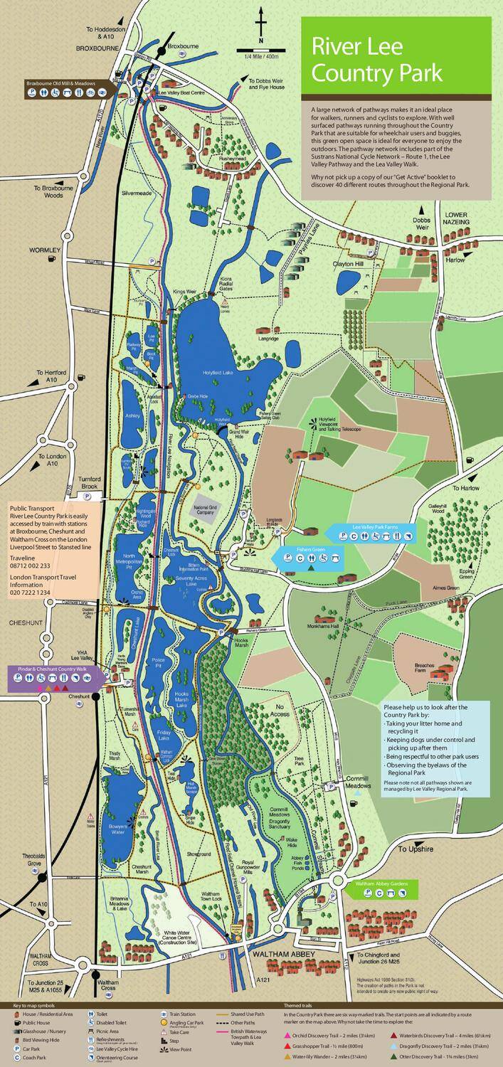
LEA VALLEY
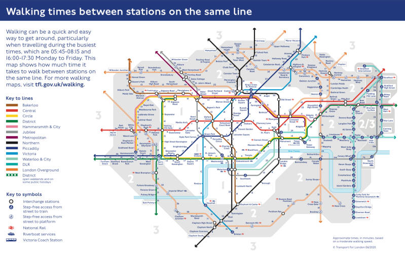
Have a look at the TUBE DIAGRAM. It is a walking times’ guide!. Only part of East London is covered.
Cycling
Ideal, as well, but the same as above: you might not want to cycle all the way to EAST LONDON fro. wherever you are based, if you deem it too far away.
What about HIRING a bike near or in EAST LONDON?

SANTANDER CYCLES covers a small part of the area. See the map

In the VIEW TUBE, on the edge of the OLYMPIC PARK, you will find bicycles to hire: chances are that NIGEL will be helping you

And, inside the OLYMPIC PARK, more precisely in the EAST WICK DISTRICT you will find WICKED BIKE REPAIR

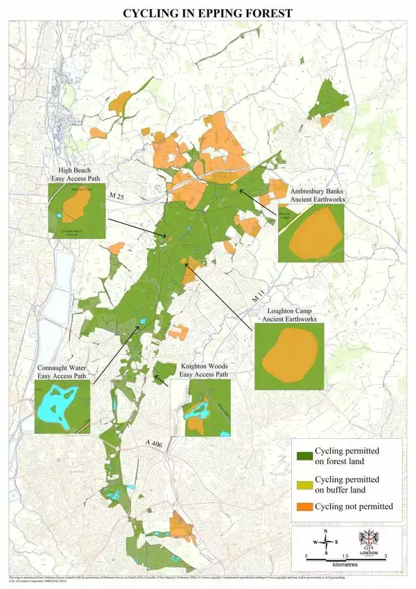
Cycling in EPPING FOREST. GFC is based very close to CHINGFORD LO Station

Of course, you always have the DEAN of bike rentals and tours, in CENTRAL LONDON: LONDON BICYCLE TOUR COMPANY, since 1991. You will find the shop, in the corner of KENNINGTON and LAMBETH ROADS, right opposite the IMPERIAL WAR MUSEUM, and only 10 min away from WATERLOO STATION and the SOUTH BANK. Even you can see me there, leading a group
LONDON BUSES
The world famous red buses connect CENTRAL LONDON with EAST LONDON. And equally you will find connections between the different areas, including routes that serve both sides of the RIVER LEA VALLEY

The best way is to check out GOOGLE or directly the TFL APP to find the bus routes most suitable for your chosen destination. BELOW, a live map

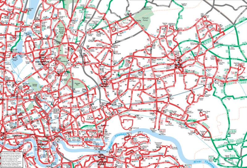
This two maps of EAST LONDON bus routes are out of date but give you a fair idea of the multiple services available.In the pre-digital times, they used to be published by TfL, and handed over freely to users. The immense majority of the routes on them are still valid. There are still some maps on sale, paper one’s or online.
Ah…! The locals for sure will give you a hand…
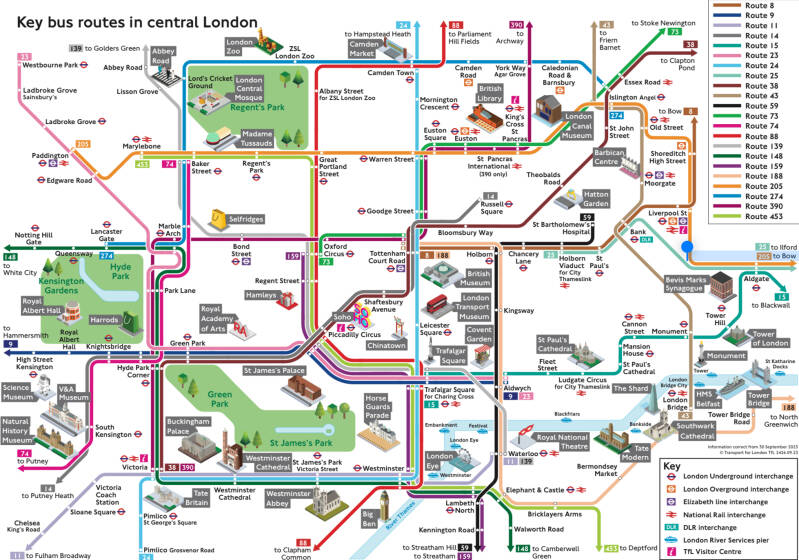
BELOW: A few routes connect Central London with East London. However this diagram is not exhaustive.
LONDON OVERGROUND
The 21rst c. LONDON OVERGROUND (yes, this network was established in the century, and was especially expanded in order to serve the venues of the 2012 OOGG and PPGG, that took place mostly in EAST LONDON. That is why the area is very well served.
You can see most of EAST LONDON (but not all of it) in this diagram. CLICK on it for the whole network diagram

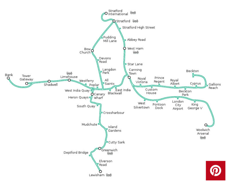
DLR
The DLR network covers the ROYAL DOCKS and gets you close to the OLYMPIC PARK
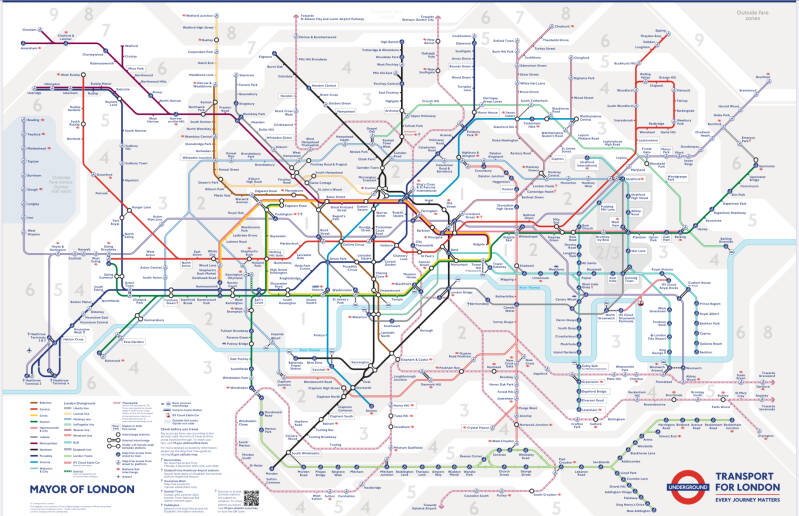
LONDON UNDERGROUND
The traditional “TUBE MAP” is no more: now you will see in this diagram all railway networks, including some lines considered part of the NATIONAL NETWORK (THAMESLINK). And, including the ELIZABETH LINE, which equally serves areas outside Greater London.
Create Your Own Website With Webador