CHINGFORD to HIGHAMS PARK
and on to WALTHAMSTOW, or WOODFORD GREEN
or to the RIVER LEA VALLEY


This trail by WALTHAM FOREST has been very helpful. The other trails have been widely used in this guide, of course.
Views over reservoirs
Towards EDMONTON
The Ridgeway
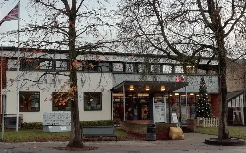
FORMER TOWN HALL
1929. Arch.FRANK NASH and H.T. BONNER. Baroque/WREN style.
Municipal offices of the URBAN DISTRICT COUNCIL, then, from 1938: HQ of the MUNICIPAL BOROUGH.
In 1960 a 2 storey block, the MUNICIPAL OFFICES, added to the SW. After being used by the LBWF for years, in 2013, it the TOWN HALL was converted to residential use, and the 1960s offices de Oli shed and redeveloped.
Church Road
MANSFIELD PARK GATES
This has been common grazing since Saxon times. However, the parallel ridges on the ground are probably signs that it was used for strip farming until early 19th c. The park appears small as you enter; there are some seats and a couple of flowerbeds planted with Japanese anemone, an unusual but effective choice. At the apparent end of the park is a gate opening onto an area of grass backed by woodland; from there a path leads down a steep hill to more woodland at the bottom. From the top, there are good views over William Girling Reservoir and King George's Reservoir. The ornamental iron entrance gates have a design incorporating the park's name and two leaping deer. Mansfield, Ridgeway and Ainslie Wood form part of the David Beckham trail put out by the Council some years ago.
RIDGEWAY PARK
CARTOON CHARACTERS
It was awarded Green Flag status in 2011, is entered via a leafy path and has many attractions. The Chingford and District Model Engineering Club, which started in the 1940s, run a miniature railway on Sunday afternoons. There is play equipment for young children, teenagers and a trim gym, as well as tennis courts and other sports areas. The park office wall has cartoon characters featured on it, perhaps recalling a visit by Walt Disney (a model train enthusiast) in 1954.
FLEEING WOMAN
FREDDY RANDALL


CHINGFORD MOUNT CEMETERY
Caroline's Mount or the Mount Caroline Estate, so-called after the wife of the Admiral who owned the land. Mount Caroline house, which was pulled down to make way for the new cemetery, was one of the oldest and largest houses in the parish, which apparently had had 'a nice garden at the back and ancient outbuildings'.
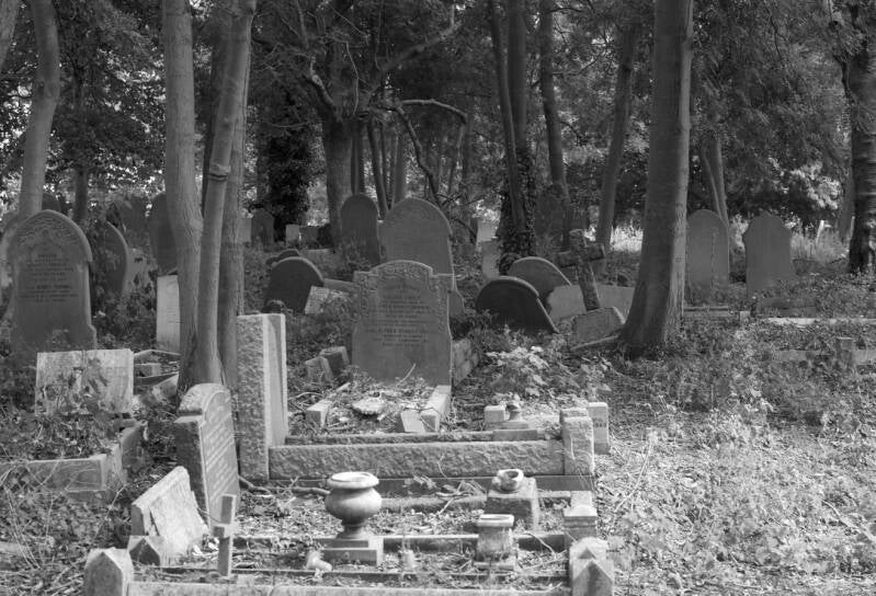
This is a sister cemetery to ABNEY PARK, STOKE NEWINGTON, which opened in response to the crises in the burial conditions in inner London. When it inherited the mantle of BUNHILL FIELDS, CITY OF LONDON, as a cemetery for Non-Conformists, allowing people of all branches of Christianity to be buried here.
When the CM CEMETERY was created, it was the first new site open under the new regime (a Joint Stock Co. (now a Corporation or Limited Co)
But, when the company collapsed in the 1970s, the LBWF took over.
GATES, RAILINGS,PIERS survive, but the original CHAPEL and GATE LODGES have gone.
Among those buried here are the sculptor John Bacon (d.1799) whose Chatham Memorial can be found in Westminster Abbey and his memorials in St Paul’s include that of Samuel Johnson; and Benjamin Pollock (d.1937), the toy theatre maker, who set up Pollock’s Toy Shop in Hoxton. One of the largest funerals seen here in recent years was that of East End gangster Ronnie Kray in 1995 which processed to Chingford Mount from St Matthew's church in Bethnal Green ; Frances Kray, the wife of his brother Reggie was also buried here in 1967.
ALL SAINTS CHURCH

This is the OLD CHURCH, as it is commonly know. The present building is 13th c., although there is a (very low) 12th c. North Wall DOOR (4 1/2 feet tall ). Evidence of Norman origins are in the Nave. The Tower is 14thc. The Chancel, 15th c. The Porch dates from 1547, and it was paid by pawning the church silver.
A 3 bay aisles nave, with clerestory. Lower chancel. Perpendicular, with tracery.
Around the piers, an arcade of pointed arches.
Outside, rubble stone, 16th c. brick, partly rendered, tile pitched roof.
The king post roof is early 20th c.
As by the 1840s the ivy was climbing its walls and roof its became known as the GREEN CHURCH. It became as well famous for ROMANTIC ART (ASHMOLEAN MJSEUM), as it had fallen into such state of deterioration that it became necessary to abandon it, falling out of any use until its restoration in 1930 (by arch.CHARLES WINMILL, with funding by LOUISA HEATHCOTE, of FRIDAY HILL).
In the Chancel sculptures and wall monument to HEATHCOTES LEGHS and othe local families.
2005.Further restoration has taken place, and now it stands as beautiful reminder of past times.
With the HALL, they are used for various activities (choir rehearsals, keep fit classes, Guides and Brownies, slimming. World…)
CHINGFORD MOUNT
This district receives the name of CAROLINE MOUNT.
A shopping area, a crossroads at the foot of the hill (MERRY HILL, CHURCH HILL, are historical names) leading to the OLD CHURCH.
Farmland until de 1850s (CHERRYDOWN, NORMANSHIRE, are the names of old farms).
With the arrival of the railways, an inn (PRINCE ALBERT) was built, and houses and shops, and finallalynthe tramway was extended in 1904 to ALBERT CORNER
Albert Crescent
DECO
BAROMETER
CLOCK TOWER
WAR MEMORIAL OBELISK

ART DECO

PAVING STONE: “PEACE YEAR 1986”

Attention, attention, you can divert alongside HALL LANE Westwards:
Towards the reservoirs, that is the VALLEY OF THE LEA RIVER

Bus 444

CHINGFORD MILL PUMPING STATION
A bit of geology
In 1873 the East London Waterworks Company acquired a water mill in what is now Lower Hall Lane, the mill was demolished and a turbine house built over the mill stream. In 1885 a well was sunk through the London Clay, Reading Beds, Thanet Sand and into the underlying Chalk which it encountered at a depth of 141 feet. The well continued through the Chalk, with its characteristic bands of flints, and terminated at a depth of 451 feet. It was an artesian well which means that the water, which was said to be of exceptional purity, initially filled the entire well and overflowed at the surface. Due to the shape of the London Basin, water in the permeable Chalk beneath London (originally rain water that has fallen on the North Downs and the Chilterns) is confined under pressure beneath the London Clay and when released forms an artesian well. Such was the success of this well that a second well was sunk into the Chalk some years later.
A water mill was recorded here at Domesday. In the 18th it was a fulling mill, but also ground for flour and cutlery.
In 1895 a delightful red brick pumping station was built and the whole pumping station complex, in a variant of the style popularised by Norman Shaw, with its TURBINE HOUSE (low half- timbered building) and railings, is now a listed building. It is situated near the old toll bridge in Lower Hall Lane. In 2007 planning consent was granted for the conversion of the disused pumping station into flats. There was a horizontal quadruple-expansion steam engine by John Cochrane, which pumped drinking water from a borehole.
The building is in two ownerships. Part of the building is being converted for residential use; part remains for utility use. The roof to the tower section is in very poor condition and rainwater goods require repair. Enforcement action for unauthorised works is ongoing. The Local Authority and Historic England are liaising with the owners to improve the condition and management of the buildings and wider site.
THE OLD HALL TAVERN

CORK TREE RETAIL PARK & HISTORICAL CORK OAK
The Cork Tree Retail Park in South Chingford was once the site of the Cork Manufacturing Company. Nothing is left of the works, but a cork oak, planted as an arboreal signpost over a century ago does survive in this most unlikely corner just off London’s thundering North Circular Road. Remarkably, the tree is thriving, showing how well adapted this Mediterranean species is to life in these northern isles, as well as a clear propensity to shrug off urban pollution.
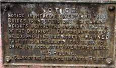
SITE OF THE OLD TOLL BRIDGE
SITE OF CHINGFORD HALL
This hall belonged to the manor of Chingford St. Pauls which had belonged to the Dean and Chapter before 1066. In 1544 it went to the Crown and then was privately owned. The manor house of Chingford St. Pauls was noted in the mid-13th as a hall with outbuildings, including a chapel and a granary enclosed with a moat. In 1709 a new owner restored the building however in the 19th this was replaced by a small yellow brick building used as offices by the Cork Company. The moat was extant until the Second World War.
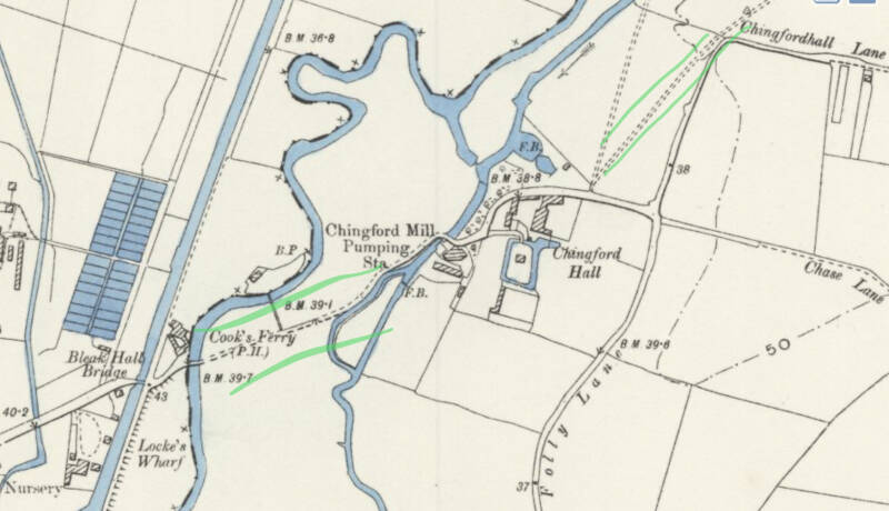
This stretch of the navigation was once on the banks of the River Lea itself. Cook’s Ferry, with its inn, was a popular crossing point for travellers between the two sides of the Lea Valley, and the two waterways ran practically side by side. On the east banks of the Lea was Becontree (detatched) this being an annexe of the main village near Dagenham. Cook’s Ferry Inn lasted until 1973 in various forms (the River Lea itself had been filled in several years before) and the North Circular Road bridge now stands where the famous inn once stood.
SITE OF COOK’S FERRY
This ferry had been the crossing of the Lea which was replaced by a toll bridge
Cooks Ferry inn – a big music pub where many headline bands played. Demolished
NORTH CIRCULAR
The first road through here ran along Angel Road and Hall Lane (now A406 to the west and A1009 to the east). It crossed the river on Bleak Hall Bridge, and passed a pub named Cook's Ferry.
North Circular Road and the original viaduct were built in the 1920s. This used Angel Road, and turned Hall Lane into a minor turning. There was another turning at Towpath Road.
The area became more industrial. In the 1960s, Harbert Road was built, which branched off from Hall Lane and then looped under the viaduct, introducing an element of grade separation to the junction.
The Lea Valley Viaduct was replaced in the 1990s, with a new dual carriageway and a new, grade separated roundabout at Cooks Ferry, and local access roads replacing the turnings. This end of Hall Lane became a minor pathway. The Cooks Ferry pub was demolished.
You are going through SOUTH CHINGFORD
South Chingford includes part of the Chingford Hall Estate which was built across the historic boundary with Walthamstow.
The area has several open spaces including Ainslie Wood, Larks Wood and Memorial Park. A small section of the River Ching flows through the area. Recently Fergal Sharkey hiked along the River Ching to raise awareness of pollution in the river.
It was previously the home of a number of factories including a large Durex condom factory which closed in 1994.[2]
RIVER LEA
RIVER LEE NAVIGATION
WILLIAM GRINLING RESERVOIR (NORTH)
BANBURY RESERVOIR (SOUTH)

You are now in EDMONTON


Back to the “regular” route. You are walking or cycling along. CHINGFORD MOUNT ROAD
THE KING’S FORD PH.WETHERSPOONS
Larkswood Road
ST.EDMUND’S CHURCH
1939. Arch. N.F.CACHEMAILLE-DAY
Cachemaille-Day was the greatest parish church designer of the interwar period. Built for posterity, his churches are monuments in their suburban setting. Cachemaille-Day’s priority was the provision of spaces that worked for local communities, fulfilling a need for buildings to represent 'their social, ceremonial and community life'.
MEMORIAL PARK

It was Chingford UDC's first municipal park. The park incorporated an existing small sunken garden with a memorial to those who died in the Great War. There is a pond with an area of formal planting, tennis courts and children's play equipment.
TAO
Ainslee Wood Road
HOUSE WITH SPECIAL GABLED END

The Chingford Dental Laboratories, on the corner of Ainslie Wood Road and Chingford Mount Road. This is not a mosaic using the normal tesserae. Various materials have been used for colour and texture variation, ranging from pebbles to tiling.
AINSLEEWOOD & LARKSWOOD

This area was part of CHINGFORD EARLS, acquired by HENRY VIII in 1544, the last owners of which being the BOOTHBY-HEATHCOTE of FRIDAY HILL. All part of the ANCIENT FOREST OF ESSEX.
Larkswood is colloquially called ”the bluebell wood”.. Mentioned in the SUBSIDY ROLLS of 1319 is the name of THOMAS LAVERK, origin of the name LARKSWOOD.
AINSLEE WOOD was privately owned until recently, and its isolation makes it a site of wildlife not usually found in such urban settings.

More to the EAST (CHINGFORD HATCH)
THE LARKSHALL PH

Part timber-framed, 16th, on the site of a farm
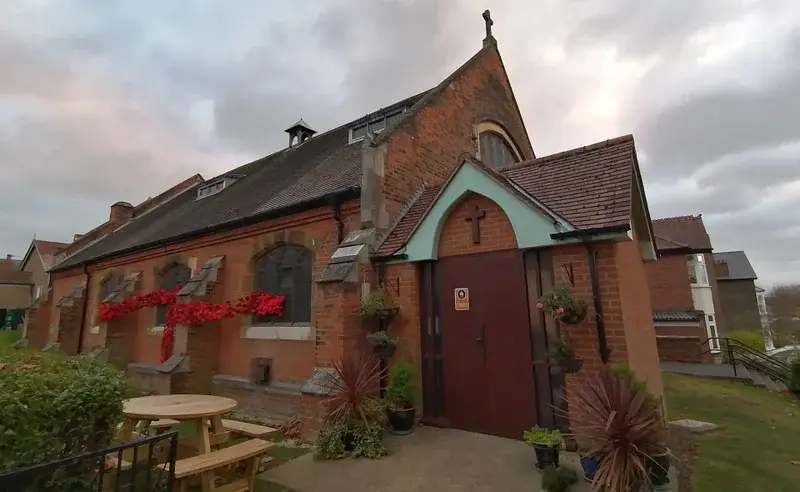
ST.ANNE’S CHURCH

1890. Originally a Mission (church)room.
1950. permanent church built and made parish of its own.
Along Underwood Road and ROPERS Avenue
ROPERS FIELD CONSERVATION AREA
The most interesting development here after WW2.
Between LARKSWOOD (a survival frag of ancient woodland) and the ROLLS site, property of the AINSLEE family.
On the site of HIGHAMS PARK CRICKET CLUB ground , where CAOTAIN EASTWOOD and fast bowler NICHOLS (he had a home in CHINGFORD) had played charity matches.
The council identified the site in 1944, when the end of the char was in sight, and, given local opposition, used its compulsory purchase power, acquiring the site. Some weatherboarded buildings of INKS GREEN FARM, later ROPERS FARM survived until the 1960s, becoming LARKSWOOD CLUB), and finally demolished.
Low density, semidetached houses and maisonettes.
Spacious layout, distinctive design, with echoes of the GARDEN CITY and GARDEN SUBURB movements, of HOWARD, PARKER, and URWIN. Homes with urban flavour and village feeling. A compromise. A loose inspiration.
Being a council development, there is elegant simplicity, where in private developments would have been assorted fanciful architectural decorations.
Low density and high standards.
Cream painted rendered finishes.
Steeply pitched roofs, and gables with clay panties.
CRITALL windows, bay windows, double height, rare in council developments.
Generous garden spaces, hedges, verges with trees.
A unique, highly desirable place to live.
Arch. REGINALD W.LANE ARIBA. With Borough Engineer and Surveyor.
Prisoners of War prepared the site. Anglo-Scottish Construction Co.Ltd.
146 homes. £235.000, considerably higher than anticipated.
Highams Park Sculpture Walk
Featuring a series of 12 wood carvings representing animals from the forest. Each animal is carved from felled trees donated by the City of London Corporation, so we can continue to enjoy their beauty.
All the sculptures in the Wild About Highams Park Animal Sculpture Trail were created with a chainsaw by artist Marshall Lambert of Natural Garden Sculptures.
You are now in
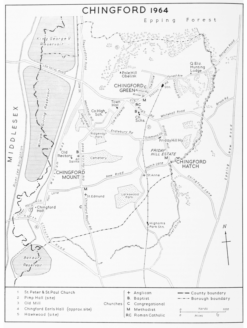
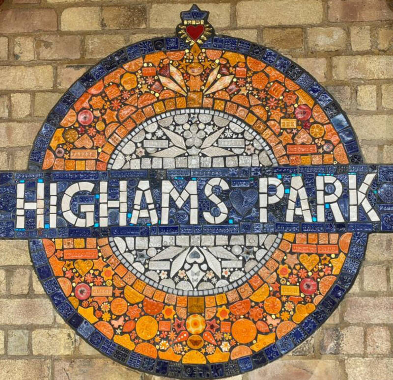
HIGHAMS PARK. See Chapter 3

Where to go:

To THE HIGHAMS PARK and WOODFORD GREEN
Pointed out on the map, HIGHAMS PARK. The PARK and, then, the GREEN are to East (Right of the map)
COUNTY SCHOOL FOR GIRLS

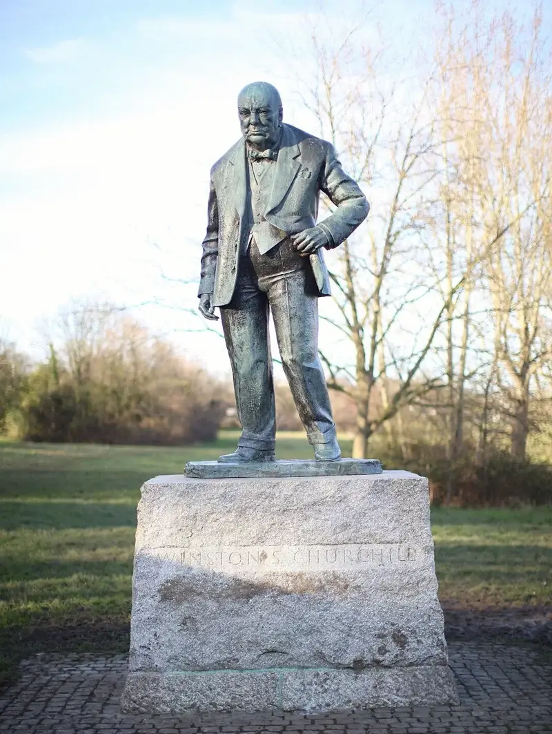
WOODFORD GREEN - CHURCHILL MEMORIAL

To WALTHAMSTOW. See chapter 3, for the same route, in opposite direction.
Following the course of the RIVER CHING
FORMER WALTHAMSTOW STADIUM












Create Your Own Website With Webador